About the Group | Reviews | Books | Compact Discs | Wills Index | Guided Walks
Contact the History Group
Programme of Events 2024
A Brief History of Walsham from 4000BC to the 1900’s
4000 BC – 43 AD | 43 AD – 1066 | 1086 – 1348 | 1349 – 1500 | 1500’s | 1600’s | 1700’s | 1800’s | 1900’s
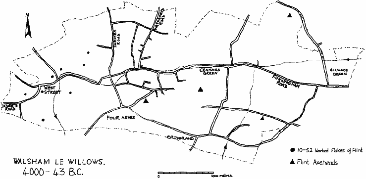
4000 BC – 43 AD
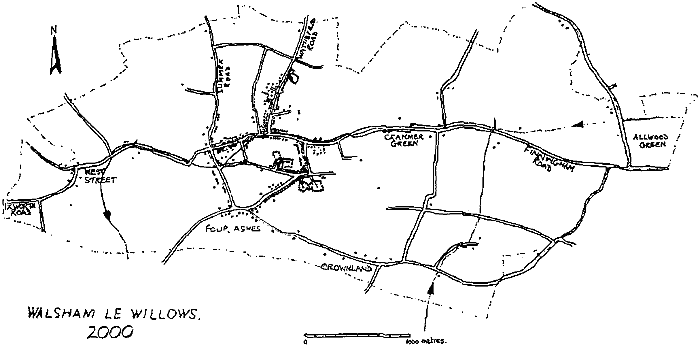
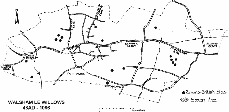
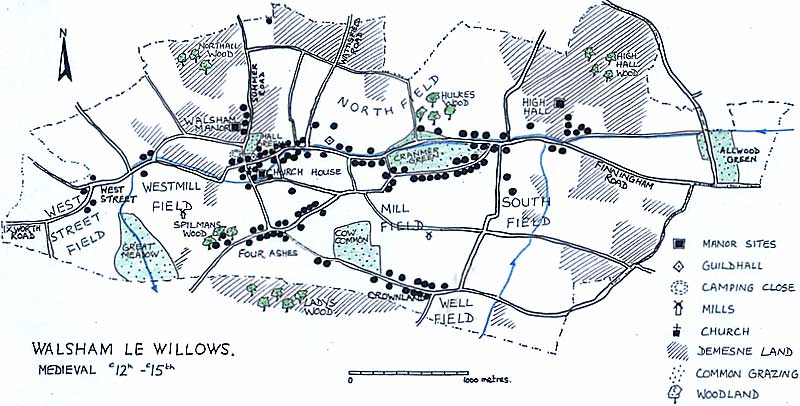
Walsham-le-Willows is a rectangular parish with a stream running down the centre. To the west the soils are predominantly gravel – to the east mainly clay. This has influenced the pattern of settlement. The first signs of human occupation occur in the Mesolithic period (c6000BC), the hunter/fisher people.
Waste flakes from pre-historic flint-knapping were found all over the parish – but the largest numbers were in the West Street area.
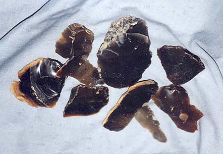
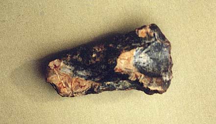
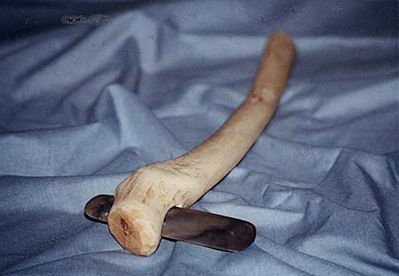
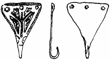
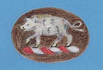
With the arrival of agriculture in the Neolithic period (c4000–2000BC), the lighter soils were more easily managed by primitive implements. The axe-head pictured below was found at Willow Tree Farm amongst a large number of flint tools and flakes – but no actual settlement.
43 AD – 1066
The earliest identifiable settlements are those of the Romanised Britons.
There was considerable Romano-British activity (late 1st – 4th centuries) – peasant farmsteads over the entire parish possibly servicing villas in Ixworth and elsewhere. There is no indication of wealthy property in Walsham.
It is likely that from the 9th century a group of extended families lived close to the present church as evidenced by a few pieces of later Saxon pottery found in just two places and a later Saxon dress-fastening.
There is a mention in Domesday of a settlement before the Norman Conquest. The place-name of Walsham is Saxon – the original form was Waeles-ham, or ham of the Welsh probably relating to surviving Romano-British inhabitants.
Syke, Bromeswong and Old Toft are Walsham field names – they may reflect some Viking influence in the 10th century.
1086 – 1348
From 1086 onwards there is written evidence and we meet the people for the first time.

After the Norman Conquest three manors emerged – Walsham, High Hall and Church House, the lords of which held regular courts in the hall of their manor to control changes of land-holding and cases of minor crimes such as over-grazing. The records of these courts survive from 1318 onwards together with some accounts and rentals.
In 1283 a tax return lists 90 people and shows that sheep were the most common animals with cattle, horses, pigs and poultry in abundance. Wheat, barley, oats, rye, beans and peas were grown. It shows for example, that Matthew Gilbert grew 4 bushels of wheat, 6 bushels of barley, 4 bushels of oats and 2 bushels of peas and kept one horse, one cow, one calf – he was worth 16s 3d and paid 6½d tax. These are the names, some of which continued in Walsham until quite recently.
A Brief History of Walsham - 1283 tax return
A list of the names (alphabetically by forename) of tenants on the 1283 Tax Return. Filter, sort and search as required.| Name |
|---|
| Adam Burchard |
| Adam le Syre |
| Adam Pinchun |
| Adam son of Godfrey |
| Agatha la Say |
| Alice Bercator |
| Alice dau of Gilbert |
| Alice de Depmere |
| Alice la Warde |
| Alice Spileman |
| Almer le Deneys |
| Andrew le Typetot |
| Anne wife of John |
| Aubry wife of W Margeri |
| Avice Barel |
| Burchard |
| Christine la Reve |
| Christine Terrewald |
| Eve de Waleyns |
| Geoffrey Payn |
| Gilbert le Do |
| H. Dodeman |
| H. Patel |
| Helis Coppelowe |
| Herebard de Cranmere |
| Hugh de la Broc |
| Humphrey le Man |
| I. le Do |
| I. son of Richard |
| Ida Payn |
| Lena la Chapman |
| Lord Roger de Walsham |
| Master John |
| Matilda Payn |
| Matthew son of Gilbert |
| Matthew Spileman |
| N. Champeneys |
| Peter Faber |
| Peter le Man |
| Peter le Rede |
| Peter son of Robert |
| Prior of Ixworth |
| R. Crane |
| R. do Aldewode |
| R. Hawes |
| R. Helle |
| R. Hernyng |
| R. le Do |
| R. le Neve |
| R. Pinful |
| R. Pudding |
| R. Robehod |
| R. Wither |
| R. Wyndilgard |
| Ralph Helewys |
| Ralph le Franceys |
| Ralph Pudding |
| Ralph Sare |
| Ralph Wiswyf |
| Reginald Sutor |
| Richard de Cranmere |
| Richard Helirof |
| Richard le Man |
| Richard Tirewald |
| Simon Kembald |
| Thomas Hunno |
| Thomas Osbern |
| W. Bercator |
| W. Bulloc |
| W. Coco |
| W. Goim |
| W. Goslyng |
| W. Hulc |
| W. Kelbel |
| W. le Franceys |
| W. le Marler |
| W. Qualm |
| W. Swift |
| W. Terrewald |
| W. Wither |
| Walter le Deneys |
| Walter le Deneys |
| Walter le Sire |
| Walter Osbern |
| Walter Payn |
| Walter Piccor |
| Walter Rampolye |
| Walter Wither |
| Warner son of Berard |
| William Payne |
There was one large open field – Mill Field – and several smaller ones where tenants held small strips to grow crops. Three large woods – Netherhawe, Northawe and Lady’s Wood provided timber. Animals could be grazed on Allwood, Cranmer and Hall Green as well as roadside verges.
In return for houses and land, the tenants paid the lord, not only in money and goods such as chickens, but by working on the lord’s own land.
Translations from the 1327 document above…
John Packard at the Feast of St. Michael ½d. And at the Feast of All Saints ¾d. And at Christmas ½d and a quarter part of one chicken. And at Easter ½d and 5 eggs. And at Pentecost ¼d. And he shall weed. And reap for 2 days and do one boon work. And he shall do 5 works in winter.
John and Adam de Angerhale brothers pay at the Feast of St. Michael 7d and at the Feast of All Saints 1¼d and half a ¼d. And at the Feast of St. Edmund 6d. And at Christmas 1d and half a chicken and at Easter 7d. And at Pentecost ½d and they shall weed. And do 12 days at harvest and 1½ days boon works. And do 10 works in winter.
Gilbert Helpe pays at the Feast of St. Michael 6d. And at the Feast of St. Edmund 6d. And at Easter 6d. And 1 chicken at Christmas and he shall reap at harvest 8 days and 1 boon work.
1349 – 1500
The Black Death Plague (published by Weidenfield, June 2008) by John Hatcher gives far more details of the Plague and it makes some interesting references to Walsham le Willows. See a review of The Black Death Plague by John Hatcher. Although it is based on certain facts you will also find that there are elements of ’embellishment’ included, but never-the-less still a very worthwhile read.
By 1349 the population had risen to about 1000 – every available corner of land was ploughed for food. Then the Black Death struck halving the population. Court rolls give the names of 119 tenants who died – wives, children and servants must be added to that number.
A Brief History of Walsham - Plague Deaths
A list of the names of tenants who died of the Black Death from the manor court roll of 1349, filter, sort and search as required.| Forename, Surname |
|---|
| Adam Angerhale |
| Adam Hardon |
| Agnes Patel |
| Agnes Rampley |
| Agnes Stonham |
| Agnes Swan |
| Alice Fuller |
| Alice Gilbert |
| Alice Kembald |
| Alice Lenne |
| Alice Tiptot |
| Avice Deneys |
| Avis Bonde |
| Bartholomew Jerico |
| Cecilia Pudding |
| Christine Crane |
| Edith Dormour |
| Edmund Patel |
| Emma Frances |
| Idonea Sare |
| Isobel Miller |
| Joan Crane |
| John Brook |
| John Chapman |
| John Deeth |
| John Goche |
| John Hawes |
| John Helpe |
| John Man |
| John Osbern |
| John Patel |
| John Pynfoul |
| John Rampley |
| John Rampley (2) |
| John Syre |
| John Taylor |
| John Taylor (2) |
| John Tiptot |
| John Warde |
| John Warde (2) |
| Juliana Deneys |
| Katherine Crane |
| Katherine Qualm |
| Katherine Taylor |
| Margery Wodebite |
| Matilda Deneys |
| Matthew Hereward |
| Nicholas Frances |
| Peter Gilbert |
| Peter Goche |
| Peter Jay |
| Peter Neve |
| Peter Taylor |
| Ralph Echeman |
| Richard Banloan |
| Richard Kebbil |
| Richard Man |
| Richard Patel |
| Richard Patel (2) |
| Richard Patel (3) |
| Richard Qualm |
| Richard Spilman |
| Robert Cook |
| Robert Cranmer |
| Robert Deneys |
| Robert Helpe |
| Robert Hereward |
| Robert Lenne |
| Robert Man |
| Robert Pertre |
| Robert Sare |
| Robert Springald |
| Robert Taylor |
| Roger Rampley |
| Rose Stronde |
| Simon Painter |
| Simon Painter (2) |
| Simon Painter (3) |
| Stephen Cooper |
| Thomas Dormour |
| Thomas Fuller |
| Walter Craske |
| Walter Deneys |
| Walter Hawes |
| Walter Hereward |
| Walter Noreys |
| Walter Noreys (2) |
| Walter Osbern |
| Walter Patel |
| Walter Payn |
| Walter Payn (2) |
| Walter Qualm |
| Walter Rampley |
| Walter Springald |
| Walter Syre |
| William Clevehog |
| William Cranmer (2) |
| William Cranmer (3) |
| William Cranmer snr |
| William Deneys |
| William Hawes |
| William Helewys |
| William Isabel |
| William Patel |
| William Patel (2) |
| William Patel (3) |
| William Payn |
| William Rampley |
| William Rampley (2) |
| William Rampley (3) |
| William Smith |
| William Syre |
| William Taylor |
| William Wauncy |
| William Wither |
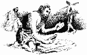
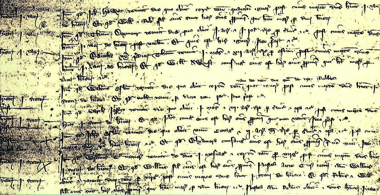
Life on the manor continued as normal – for each death the lord collected a heriot – the best beast as a death duty and example of whcih is extracted below:
“Heriot 1 cow – Item that John Hawes held on the day that he died a certain tenement the size of which is unknown, after whose death the lord had 1 cow as a heriot. And that William and Robert his sons are his nearest heirs who have entry by the said heriot.”
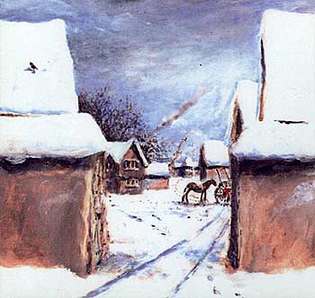
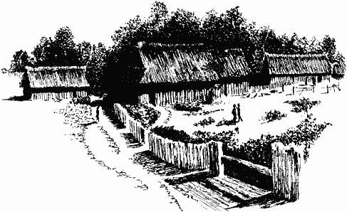
The manor site may have looked like something like as depicted in this image.
One of the items in the manor account rolls is for building work done on the manor site along Summer Road. The following buildings were repaired from time to time, mostly by thatching and carpentry:
The lord’s house (although he was rarely resident) and the knight’s room (for visiting aristocracy). Also a chapel, bailiff’s room, lodge, kitchen, stable, sheepcote, cowshed, barn, dairy, granary, oat barn, wash house, pea barn, hay barn and walls topped with thatch.
The dovecote was at the back of the site (in the field known, until quite recently, as Dovehouse Close, another hated symbol of feudalism) where the lord’s pigeons fed on the peasants’ crops but they were not allowed to harm them.
The Hawes family lived where the Rookery now stands. Other deaths recorded here are Thomas Dormour, Edith his wife, Walter Osbern, Bartholomew Jerico, John Osbern, William Cranmer, William his son and Robert his son.
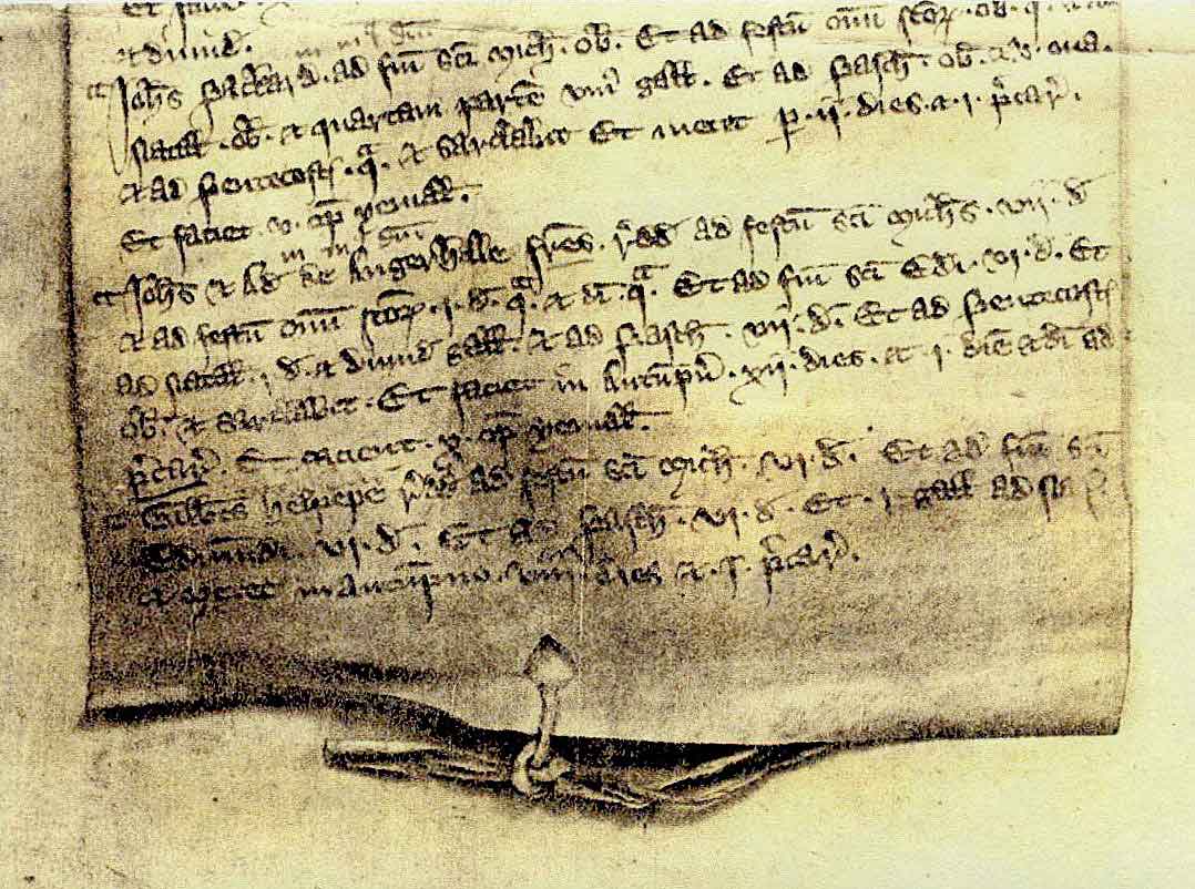
Part of an account of the manor in 1390/1 written in medieval Latin it shows that the costs of the mill amount to 9d and the costs of the sheepfold to 20s 4d.

“Cost of mill – In stipend of John Manser and his sons for one and a quarter days making cobbles and bedding them in the mill and for making one key for binding the heads of the axles of the mill – 9d, taken between them per day – 7d. In pegs bought for the top-plates of a house at the mill – ½d. Sum – 9½d. Approved. Cost of sheep-fold – In one barrel of tar bought for sheep salve – 4s 3d. Item in oil bought to mix with the same for sheep and lambs of this manor and wethers from Wattisfield – 5s 1d. In expenses of various men helping to grease hoggets at times this year – 10d. Item in 282 sheep and 394 lambs from this manor and wethers from Wattisfield, washing and shearing this year – 10s, from which in the price of 1 bushel of wheat sold to them. In reddening bought for marking sheep twice – 2d. Sum – 20s 4d. Approved.”
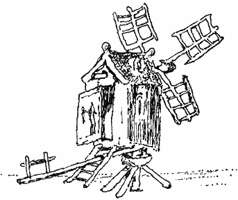
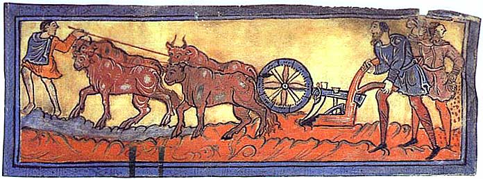
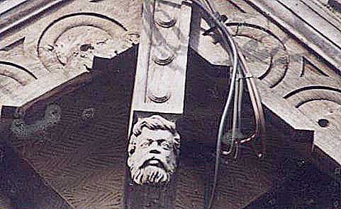
There were two windmills, or ‘post-mills‘, – one along Mill Lane, north of Ridings farm and one north of Badwell Road. Peasants were obliged to grind their corn at these, the lord’s mills, paying for the service. Although they were not allowed to use their own mills, plenty of broken hand querns were found during field walking which is evidence that they broke the rules!
Most of St Mary’s church was built in the early 15th century and gradually evolved to its present form evidenced by the wall above the chancel arch where the line of the original gable can be seen and by the fact that in their wills, nine men left money or goods to be used for building work on the church.


The first court of William de la Pole and Alice his wife was held on 9th February 1441. After William’s untimely death in 1450, Alice continued as lady of the manor until her death in 1475.
Their son John then held his first court.
His wife Elizabeth was born Elizabeth Plantagenet, sister to Edward IV and Richard III – she influenced the decorative scheme of Walsham church eg. the rose en soleil which was Edward’s favourite device.
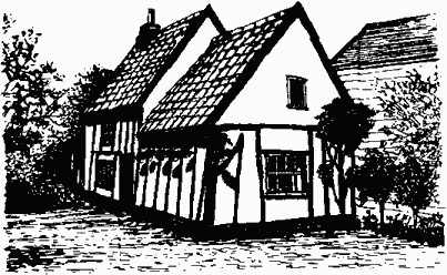
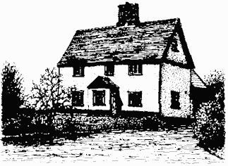
At least ten houses remain, although much altered, from the 15th century – Garden Cottage (shown above), at Four Ashes is one of them.
Once the population was reduced, there was no need to grow so much grain – the land began to be enclosed for pasture. There were fewer peasants to farm the lord’s demesne (his own land) and he started to pay for this work to be done. The tenants then began to pay cash rent, relieving them of their onerous duties – the feudal system was coming to an end.
The 1500’s

The document to the left is part of a rental of 1509 showing rents, in money, owed by each tenant. Walsham town held St. Katherine’s and Master John’s Close.
The 16th century saw the open fields being enclosed with hedges and used as pasture.
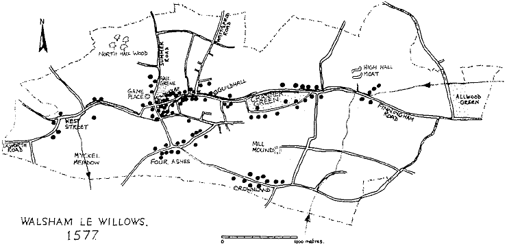
When the land was first surveyed in 1577, over half the total acreage of the parish was used for grazing.
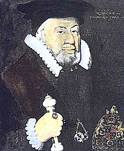
After schooling in Bury St. Edmunds, Sir Nicolas Bacon, pictured left, trained as a lawyer and rose to become Lord Chancellor under Queen Elizabeth. He became lord of Church House manor in 1551 and of Walsham manor in 1559.
Although unpopular locally, it is due to his careful keeping of manorial documents in his muniment room at Redgrave Hall that we have access to so much of Walsham’s early history.
In 1577 he commissioned a survey of all the holdings – the Field Book – and it is possible to recreate a map showing who lived where.
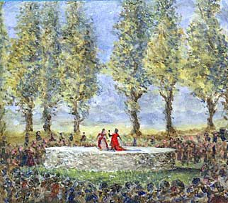
This will of John Robwood dated 1537 is the first known addition of “Willows” to the place name of Walsham. One entry in the Field Book describes the Game Place.
“a place compassed rownd with a fayer banke sett with and cast up on a good height and havinge many great trees called populers growynge about the same banke, in the myddest a fayre round place of earth wyth a stone wall about the same to the height of the earth made of purpose for the use of stage playes”.
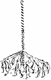
Game Place was situated in Summer Road – an amphitheatre on a half acre site.
Small companies of visiting players entertained villagers with plays featuring “Mankind and Mischief”.
Such acting spaces influenced the circular theatres like Shakespeare’s Globe in the 1590s.
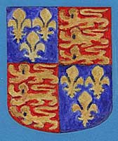
The English Royal Arms from 1405 to 1603 – in the east window of St. Mary’s church.
The 1878 restoration inserted the shield back to front!
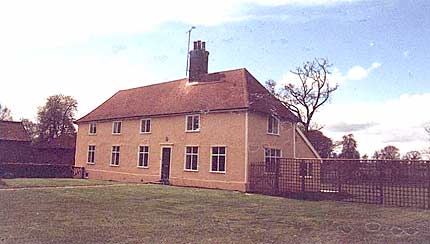
Church Farmhouse was built c1530 and occupied by Walter Martin. He was a blacksmith – in his will of 1555 he left his “stethys and hamers” in his shop to his sons Nicholas and John to carry on his trade.
The parlour was added c1580.
The 1600’s
Although Walsham never had a large estate or very wealthy landowners, the 17th century was a time of agricultural expansion. The yeomen enlarged their holdings and built new houses, many of which still remain. Some of the larger landowners called themselves gentlemen. This was a period of ostentation – if you had it, you showed it off. East Anglia was staunchly Protestant, many finding the Church of England not radical enough in its opposition to Roman Catholicism. At Walsham there was support for Parliament.
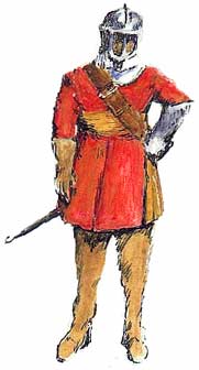
A member of an old Walsham family, Ralph Margery of Summer Road became a cavalry captain in Cromwell’s New Model Army. He served in many campaigns and died at Walsham aged 61 in 1653. Like most villagers of that time he lies in an unmarked grave in the churchyard. No portrait exists, but Cromwell commended “Mr. Margery” when speaking of the “plain russet-coated captains” who formed the backbone of his army. This figure wears such a coat, with an officer’s tawny sash and a cavalryman’s armed left gauntlet.
John Salkeld, who lived at Woodlands in Finningham Road was a Presbyterian cleric who had been expelled from his living at Worlington. He continued to preach and was imprisoned for his outspoken opinions of the Restoration church. He died in 1699 and his inventory included sixteen leather chairs, window curtains and books worth £30.
From a court roll of 1694:
“The view of the homage – And that the Elme Tree in question between Mr. Salkeld and Mr. Hagtree [who lived at the Rookery] is found by the Jury aforesaid to belong to Mr. Hagtree (it is a wild elme). And that Mr. Hagtree ought to repair the fences upon the ditch where the said tree now grows att his owne charge”.
The Herbage Book of 1625 lists ninety tithe paying tenants. Fifty-four people kept a total of nearly 500 cows and even more calves. Some made payments for arable land, meadow, orchards, hops and hemp.
Small fields of hemp were grown to supply the weavers of course linen, sacks, etc. Flax is mentioned in one inventory – used to make finer material. There were several linen weavers and whitesters (bleachers) in Walsham.
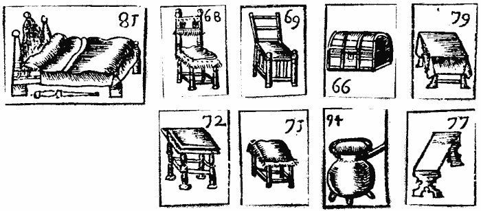
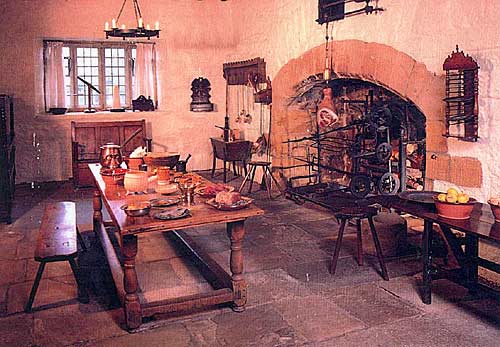
Inventories, mainly of the 17th century, list and value the goods of the recently dead. They state the rooms in which the goods were found, so give information about the size of houses as well as of furniture and animals kept, etc. They often state occupations.
| In the hall – One table, one livery cupboard, one other cupboard, one clock, a jack, a spit, six joined stools, six chairs, cobirons, fire pan and tongs and other lumber | £4 | 0s | 0d |
| In the parlour – In bonds, bills, mortgages and ready money | £112 | 0s | 0d |
| One feather bed and bedstead as it stands | £5 | 0s | 0d |
| One trundle bed as it stands | £1 | 0s | 0d |
| A press and table, a coffer, a form, three stools, a chair with other things | £2 | 1s | 0d |
| A silver cup, two silver spoons | £2 | 10s | 0d |
| His apparel | £3 | 0s | 0d |
| In the buttery – Two brass pots, two kettles, four skillets | £1 | 10s | 0d |
| Thirty pieces of pewter | £2 | 0s | 0d |
| Four beer vessels, a keepe and other lumber | £1 | 0s | 0d |
| In the other buttery – A table, a boulting hutch and other things | £1 | 0s | 0d |
| In the parlour chamber – A feather bed as it stands | £4 | 10s | 0d |
| A livery cupboard, a little table, a chest and a box | £1 | 0s | 0d |
| Two chairs, a trunk, a stool | 14s | 0d | |
| Twelve pairs of sheets, napkins and other things | £10 | 0s | 0d |
| In the hall chamber – A bed as it stands, two stools, a chair | £3 | 5s | 0d |
| In the roof – Ten waye [a waye was 256 lbs] of cheese | £4 | 0s | 0d |
| Ten firkins [a firkin was 9 gallons] of butter | £10 | 0s | 0d |
| In the back house – A copper, two kettles and other things | £1 | 0s | 0d |
| In the dairy – Two churns, three tubs, four keelers, twelve bowls | £2 | 15s | 0d |
| Scales, weights, cheese vats | £1 | 10s | 0d |
| Bacon in the salt | £1 | 0s | 0d |
| A saddle and other things | £1 | 0s | 0d |
| Hay in the barn | £3 | 0s | 0d |
| Wood in the yard | £1 | 0s | 0d |
| Six cows | £18 | 0s | 0d |
| Sum Total | £199 | 4s | 0d |
| John Rainbird, Thomas Taylor, Christopher Smeare senior. |
Ridings Farmhouse at the end of Crownland Road, built in the early 17th century improving an earlier house, is a typical yeoman’s
tenement.
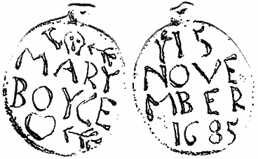
Each year, on 15th November, a garland is placed on the crance of Mary Boyce in St. Mary’s church – the anniversary of her death in 1685, aged 20. She is said to have died of a broken heart.
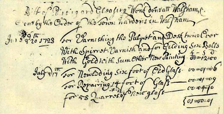
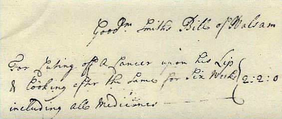
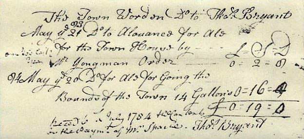
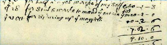
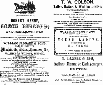
The 1700’s
All the information on this 18th century page comes from the Town Wardens’ Accounts that can be found in the Record Office in Bury St. Edmunds. The Town Wardens were, in a sense, forerunners of the Parish Council.
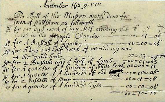
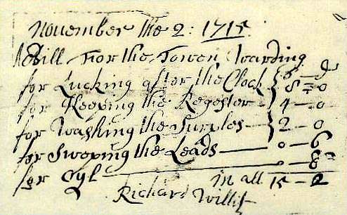
A Bill for the Townwardens
for looking after the clock 8s 0d
for keeping the register 4s 0d
for washing the surplice 2s 0d
for sweeping the leads 6d
for oil 8d
in all 15s 2dRichard Willit
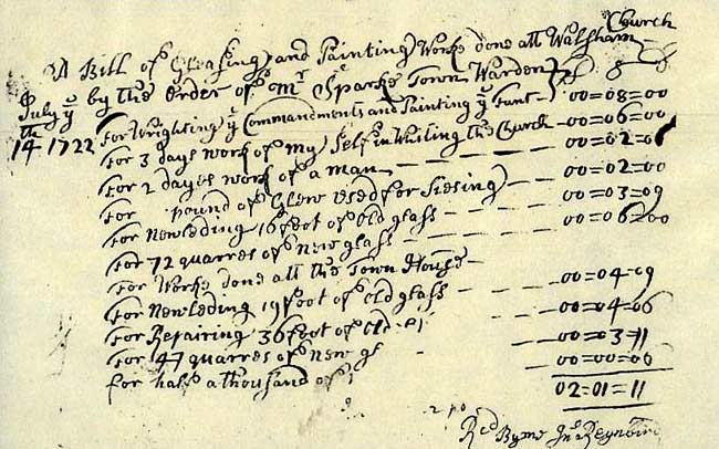
For writing the commandments and painting the font 8s 0d
For 3 days work of myself in whiting the Church 6s 0d
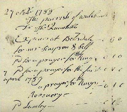
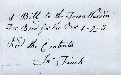
A bill to the Town Wardens for bread for the poor £1 2s 3d. Received the contents – John Finch.
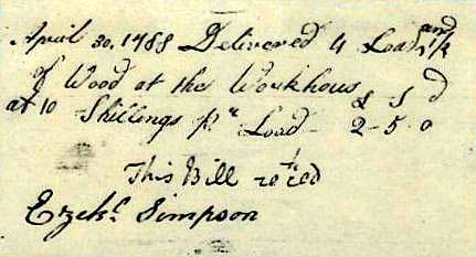
April 30 1788 Delivered 4 loads and a half of wood at the workhouse at 10s per load £2 5s 0d. This Bill received – Ezekiel Simpson.
The 1800’s
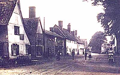
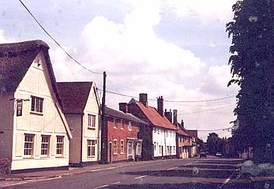
The 19th century saw a huge increase in population rising to a peak of 1297 in 1851. Today we are just about back to that number. Most of the houses were timber-framed and thatched and many were divided into two or three dwellings to house several families. This was obviously a fire hazard and a local fire brigade was formed to deal with that problem. New dwellings, filling in gaps between the old, were built of red brick and slate (now transported cheaply by rail).
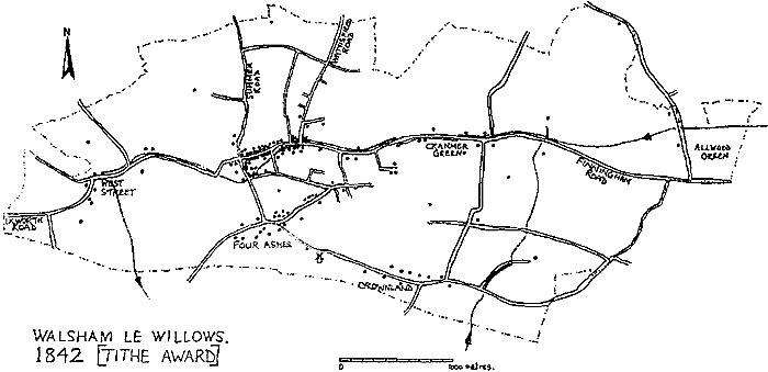
In 1819 the remaining common grazing land at Cranmer Green and Allwood Green was enclosed and numerous footpaths, used as short cuts, were stopped up. The Enclosure Map of 1819, a slightly earlier Parish Map of 1817 and the Tithe Map of 1842 show hundreds of small fields used for a mixture of arable crops and pasture surrounded by miles of hedges. The maps also give a first accurate indication of who lived where and what land they owned and/or occupied.
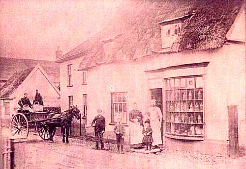
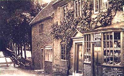
In the first directory of Suffolk, Walsham is shown to have a milliner, thatcher, baker, plumber, cooper, gun-maker, brewer, maltster, smith, shoemaker, saddler and rope-maker. The village was a hive of activity with shops and workplaces meeting most of the residents’ needs.
Printed sources, in the form of census and county directories, begin to give accurate information. This is from Harrod’s Directory of Suffolk for 1864.
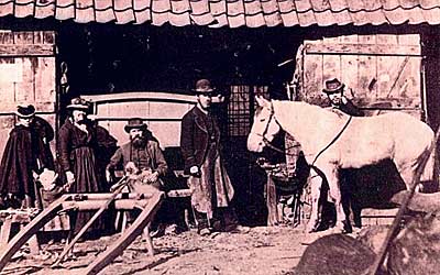
1870 – The Stevens family who were smiths, coopers and wheelwrights living and working at the house now called Dages.
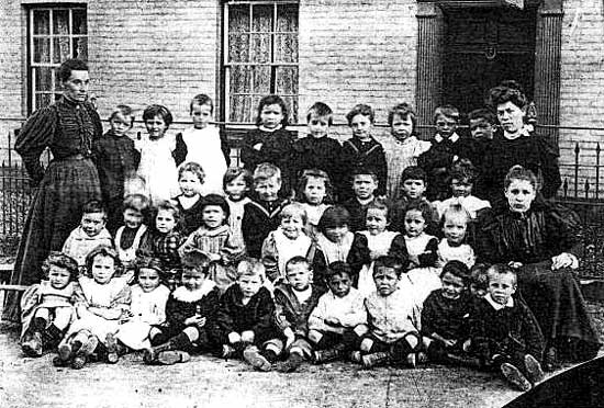
The infant school was founded in 1872 although the younger children were taught in the village before that date. The Martineau family financed the site and building, which is now a private house. Parents paid a penny a week per child. The main school was founded in 1848. The site, the building, the furniture and the books were provided by trustees at a total cost of £395 18s 2d. It became the National School in 1870 when education became compulsory.
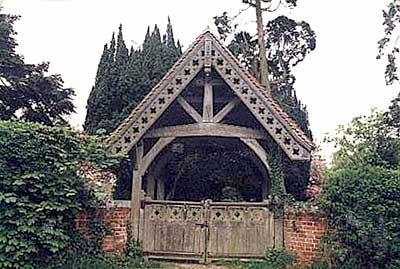
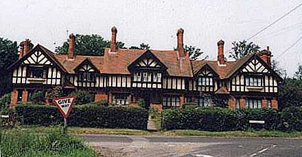
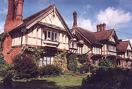
In 1877 Harry Nunn established a large building firm. By 1896 he employed fifty local men and built the attractive and substantial mock-Jacobean cottages with the carved texts for the employees of John Martineau. The lych gate at the entrance to the churchyard extension is an example of his workmanship. By 1908, Kelly’s Directory lists his concerns as builder, agent for agricultural implements, ironmongery, timber, sawing and grist mills, acetylene gas and electric house bell installation, posting establishment, undertakers and garden produce.
The 1900’s
Most of the 20th century is within living memory. Ordinary life was disrupted by two world wars – thirty-six young men were killed in the first and three more in the second. The century has seen big changes in labour patterns, from most people working on the land or in the village to working in nearby towns, although Clarkes the builders merchants still employ over 100 people.
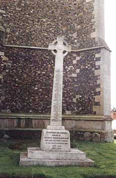
The names of the men are inscribed on the war memorial.
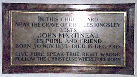
The Martineau family have been major landholders in the parish for 200 years. It was John Martineau (1834–1910) who was responsible for the elaborate estate cottages. He lived in Hampshire where he first built similar dwellings in Eversley, Hants to improve the living conditions of working people.
The memorial pictured below to John Martineau in Eversley, Hampshire states that he rests near the grave of Charles Kingsley, his teacher and friend.
The memorial pictured below to John Martineau in Eversley, Hampshire states that he rests near the grave of Charles Kingsley, his teacher and friend.
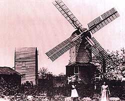
The post-mill along Wattisfield Road is shown on the 1817 parish map. It was demolished in 1917 after which the stones were driven by an oil engine. It was converted to electricity at a later date and continued milling flour until fairly recently. The roundhouse still survives.
Although many hedges were destroyed to make way for large farm machinery, there is now a renewed interest in conservation. New hedges and trees are being planted for the benefit of wildlife.